
This List reflects what TNN has published and done locally from its inception 19 years ago to date. The emphasis is on current concerns believed to have long legs to guide TNN going forward. The List is informed by recent dialogue with community groups. And also by conversations with members of the TNN Board; and marketing and technical insight from TNN’s local website developer. TNN Interests and Initiatives provides the organizing principles for the new TNN Website. This structure enables the public to research TNN’s body of work consistent with the guidance put in place by the founders and administered by the TNN Board.
Elk Rapids to Norwood. The good news is, that 50% of the shoreline has been preserved. What can we do locally? Walk the beach – Walk the Wilcox- Palmer-Shah Nature Preserve to see what the natural shoreline looks like. Apply what you see to your land.
Waterfront HOA’s have sent deed restrictive covenants to land- owners. these recorded covenants run with the land. It is incumbent on a buyer to discover restrictive covenants through title search and inquiries to the local HOA Board. Related: Docks/Hoists are accessory structures in zoning law. Milton and Torch Lake Townships require 10' side setback. This zoning setback applies to docks on the Bay stored above OHWM (580.5 feet). Stricter covenant setbacks prevail over zoning law. Contact your local zoning administrator.
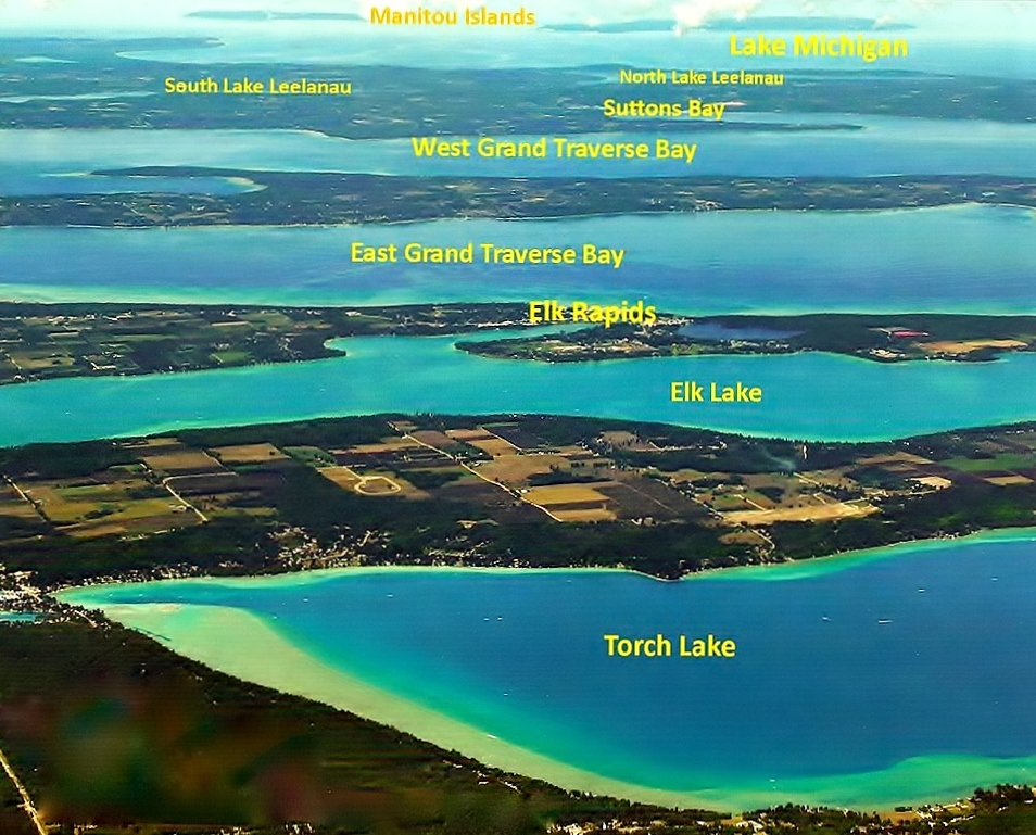
EASTB Watershed has 4% of Grand Traverse Bay water inflows with 24 streams entering the Bay – twice that number in total (map) from Elk Rapids to Norwood. EASTB has forested residential living along East Bay beaches, inland living in dune settings, rural homes, villages, farms and businesses. Upland farms feature orchards, vineyards, row crops, and confined or pastured cows. Uplands drain through 3 local creeks; Mitchell Creek incl. Mud Lake in its 12 sq. mile basin, Paradine McGuire Creek and Creswell Creek. TNN cooperates with the Watershed Center – GT Bay, Tip of the Mitt Watershed Council. Part of the overall MDEQ and EPA sanctioned GT Bay Watershed Protection Plan.
Great Lakes record highs in 2020 flooded lands New York to Minnesota including coastal wetlands. Wildlife and people rely on nature’s sponges, soaking up water for slow release. Fewer wetlands mean more floods and erosion. Hundreds of plant and animal species are becoming displaced. What can we do locally? Protect wetlands, build new ones; make room for the water on your property. Work with Data: L. Michigan–Huron Levels, Temps, Flows ROWI website. Down over two feet from the all-time 2020 high. About 3% of statewide waterfront lots placed rocks alongshore. In my case with a beach-building break-water. Forecast of water levels is difficult and unreliable - 30-day forecasts are OK: 60 days 50/50 and 90 days the best guess. Multiyear models are paradox-biased by extreme climate change beliefs. No expert forecasted the 2020 record rise or the record low 1997-2013. What can we do locally – follow the water down as levels drop: plant Marram grass in Sept/Oct., plant native trees and shrubs, protect native flora; destroy invasives; share success stories.
Active democracy overcame official inaction as homeowners acted resolutely. Antrim County, Lake Michigan coastal residents’ struggled for decades to protect East Bay's natural shoreline. The people’s efforts were overwhelmed by 2020 crisis high water. Spring and summer storms took 8 feet off a coved beach – 80 feet in 5 years. Homeowners hardened their shorelines with seawalls first on headlands, then high bluffs, and finally coved beaches. And also by sill-type offshore breakwaters. The people adapted and improvised.
Sill type breakwaters trapped sand in the gales of November until spring. Then were buried beneath two feet of new sand, wind-blown sand came in, and water levels came down. Even as southeast Michigan was flooded by 100-year storms and slow or blocked sewers. Utter destruction in walkouts and basements. Furniture, equipment, drywall, and lifetime memories destroyed - removed by family, friends, and trusted contractors. Finally the root cause of blocked storm and combined sewers were cleared. High water and extreme rainfall will return. The answer is adapt and improvise now for resiliency.
An Autumn 2019 TNN Field study shows there are very few macro-invertebrates found near the East Bayshore at Mitchell Creek. This is due to the lack of diverse habitat for colonization. (The Creek mouth detached from East Bay was not sampled). Invertebrates were few as are rooted plants which offer best habitat for macro invertebrate colonies. No birds, amphibians, fish, aquatic plants to 3.3 feet were seen. A small bit of Cladophora on large cobble nearshore was normal for the Great Lakes and NOT indicative of nutrient loading. The whale in the Bay (elephant in the room) is that the Grand Traverse Bay food chain has been decimated by invasive deep-water Quagga mussels. To restore the food chain, Quagga mussels have to be killed, removed, or controlled as are sea lampreys. Authorities show little urgency with scattered research over a decade. There is currently no large-scale action to kill/remove/control invasive Quagga mussels. The number and type of fish in the Bay will continue to worsen unless action is taken.
160 years of mankind’s diversions, re-channeling and control structures amplify extreme water levels of Great Lakes since 1865 – Supports restoring natural 4 foot range (not 6’); bi-national field study of St. Clair River bottom contours.
Damaging consequences of alterations amplify water level extremes. Record-setting high and low water are worse and more frequent due to an altered Great Lakes system since 1865: Diversions in (Long Lac-Ogoki L. Superior) and out of L. Michigan (Chicago ). Channels changed between the Lakes in St. Mary’s River and silting and scouring of the St. Clair River has been altered. Outflow is regulated from Lakes Superior and Ontario. Not Lake Michigan - Huron.
TNN is part of an initiative to restore a natural 4-foot range (not 6 feet) with partner ROWI. A bi-national field study has been requested to measure bottom contours of the St. Clair River. Properties alongshore in legislative districts have suffered as a result. What can we do locally? Support US and Canadian study the SCR and cumulative damage alongshore.
Failure rates of modern septic systems are less than 1.0%. Cases of septic tank waste entering waters are nearly always from land disposal of pumped waste - grandfathered by the State - so authorities will not discuss it. What can we do locally? Inspect the septic system every few years, and add root killers and enzymes. Pump-out only by contractors who always take waste to a sewage treatment plant.
Elk Rapids, MI 49629