Viewing posts for the category East Arm Shoreline of Traverse Bay- EASTB Sub-Watershed Protection Plan

A look at East GT Bay beaches from 2003 to 2019 all-time high and 2013 all-time low. Water levels were 581.59 feet above sea level for the high and 576.15 ...

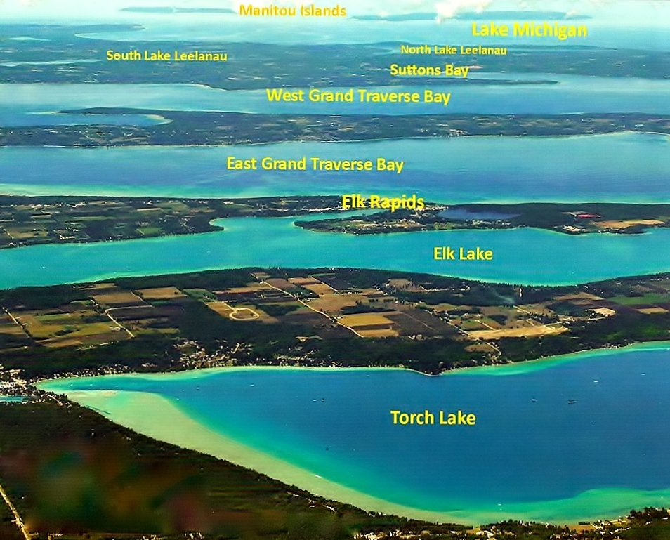
This sub-watershed of GT Bay lies in Antrim County and a bit of Charlevoix County. It has 24 transient streams, 3 permanent streams, and wetlands. It consists of East Bay ...

OPEN WATER ZEQUANOX TRIAL TO KILL INVASIVE MUSSELS This field trial was conducted in a small lake east of here last July. There will be follow-up surveys this summer with ...

GT Bay E.A.S.T Shore (Map) 15 miles Eastport to Elk Rapids – Great Scenery - Long Vistas - Varied Habitats - Beaches better than in low water years ...

This amazing shoreline provides great scenery, long vistas, diverse habitats, and beach recreation. Water levels change with storms, seasons and decades. Beaches are much better than in the low water years. ...
2026
2025
2024
2023
2022
2021
2020
2019
2018
2017
2016
Elk Rapids, MI 49629